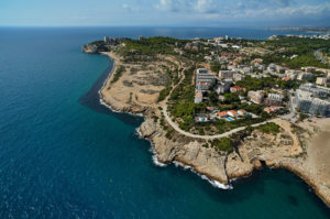
This is one of the most beautiful and emblematic of the Costa Dorada trips: the Camino de Ronda, recently remodeled and with spectacular views, bordering the Cap Salou. This route has a low level of difficulty and although the road reaches a maximum height of 77 meters above the sea level, with sections having a little difficulty, most of the route is practicable for everyone. Through gateways , stairs and paths lead us to much of the coves and beaches of Cap Salou.
This is one of the most beautiful and emblematic of the Costa Dorada trips: the Camino de Ronda, recently remodeled and with spectacular views, bordering the Cap Salou. This route has a low level of difficulty and although the road reaches a maximum height of 77 meters above the sea level, with sections having a little difficulty, most of the route is practicable for
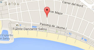
The Camino de Ronda begins at the end of Calle Colon, right on the esplanade of Pilons. Continue on the boardwalk and soon you will found the remains of an old building, “Lazareto”, built in 1829, where formerly insulated vessels coming from endemic areas and retaining solid walls several meters high. Continuing the walkway that borders this construction as a zig zag, we discover one of the most charming coves of Cap Salou, Playa de Capellans, with paths and stairs that lead a path of cobblestones half buried in beach sand. Once the Capellans beach, climb the stairs with a slope to access the Punta del Po-Roig.

From this place you enjoy superb panoramic views and is easy to imagine how boats and ships made the stop in Salou throughout history. Salou has a natural harbor, which was formerly the only one in the Catalan coast from Cap de Creus to the Port Fangós in the Delta de l’Ebre. For this reason it was already chosen in the thirteenth century by Jaume I to concentrate on these vessels should conquer Mallorca. Were numerous maritime expeditions that left or arrived in Salou, as this natural harbor gave them temporary shelter in case. For the same reason, centuries later, especially XVI, this coast is accustomed to the arrival of pirate expeditions that brought ruin the old town of Barenys, and now part of the municipality of Salou.
Have subsequently been many historical events that has led the port of Salou, since the expulsion of the Jesuits to Italy, the arrival of the relic arm of Santa Tecla patron saint of Tarragona, or the arrival triumphant General Prim coming from the War Africa and was received here with great solemnity and celebration for reusenses. On top of this spectacular viewpoint two “pillboxes” of the Spanish Civil War, which served to prevent a hypothetical attack by sea or beach landing Capellans or Cala dels Llenguadets are preserved.
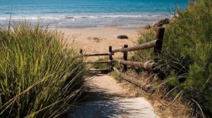
Then along a corridor of bushes, we saw one of the most beautiful and pristine beaches of Salou:: La Playa Larga (Long Beach). This beach can be overcome by rubbing sand sea or a walk full of vegetation that goes through the top. Right after this beach is the area of the Replanells, ending zone in infrastructure remodeled Camino de Ronda. Then the way along the coast path is complicated and loses continuity. If you have been wanting to keep walking, an alternative is to go to Cala Crancs or go to Punta del Cavall, idyllic lookout for review with the look all the way done.
In the middle of Cap Salou we found a place of great geological interest, Cala Crancs, where a series of coves and beaches of various dimensions create unique spots. Large rocks into the sea and form natural walls between the coves, capriciously eroded by the wind. These beaches were preferred by the pirates of the time, as there are dozens of documented landing of these former wrongdoers, seeking shelter and make slaves among the peoples of this then uninhabited land.

Then after Cala Crancs, we follow the route of about 350 meters. until the Faro of Salou.
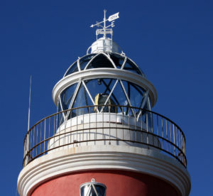
Salou Lighthouse (Faro de Salou): Opened in April 1858, has a central tower red color even today, day after day, illuminates the gulf of San Jordi of the Costa Daurada. It had a white light fueled by olive oil, which could be seen from 14 miles. Two lighthouse keepers were responsible for making it work. Then, as the years passed, the technology was implemented. Annex is another building that had been occupied by the engineer and the “torrero”. The restoration of the site was conducted in a very friendly way with the natural environment. So you can see native plants such as asparagus, white pine, sea lily, the agave or vernal, among others. Also, three viewpoints distributed along the route allow stop and enjoy the Costa Daurada with all its splendor. One of the most unique is the south viewpoint, from the mountains of the Sierra de Llabería can be seen. At this point you can also enjoy the view of twenty seabirds that frequent this place.
Estimated time: 1 hour 15 minutes
Route: 5.5 km.


Leave a Comment
You must be logged in to post a comment.